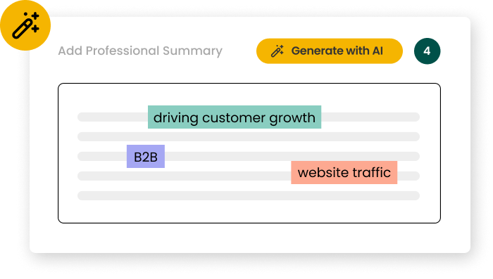
GIS professionals must now balance technical mapping expertise with broader analytical and communication skills. These GIS resume examples for 2025 demonstrate how to highlight your spatial analysis capabilities alongside crucial skills like data visualization and cross-departmental collaboration. Maps tell stories. Use these examples to frame your technical proficiency and problem-solving approach in ways that show potential employers how you translate complex spatial data into actionable insights.
Seasoned GIS Developer with 10+ years of expertise in spatial data analysis and custom software development. Proficient in advanced machine learning integration, cloud-based GIS solutions, and real-time data visualization. Spearheaded a city-wide smart mapping project, reducing emergency response times by 30%. Adept at leading cross-functional teams and driving innovation in geospatial technology.
WORK EXPERIENCE
GIS Developer
02/2024 – Present
Redwood Ion
Spearheaded the development of a cutting-edge 3D urban planning platform, integrating AI-driven predictive modeling and real-time IoT data, resulting in a 40% improvement in city infrastructure planning efficiency for a major metropolitan area.
Led a cross-functional team of 15 developers in implementing a cloud-native, scalable GIS solution using containerization and serverless architecture, reducing infrastructure costs by 35% while improving system performance by 60%.
Pioneered the adoption of quantum computing algorithms for complex spatial analysis, enabling the processing of massive datasets 100x faster than traditional methods, revolutionizing environmental impact assessments for large-scale projects.
GIS Analyst
09/2021 – 01/2024
Trovex & Co.
Developed and deployed a machine learning-powered land use classification system, achieving 95% accuracy in automatically categorizing satellite imagery, reducing manual processing time by 80% for a national mapping agency.
Designed and implemented a blockchain-based land registry system for a developing country, securing over 5 million property records and reducing land disputes by 70% within the first year of operation.
Orchestrated the migration of legacy GIS systems to a microservices architecture, improving system reliability by 99.99% and enabling rapid feature development with continuous integration and deployment practices.
GIS Technician
12/2019 – 08/2021
Mistral Vale
Created a mobile AR application for field data collection, increasing data accuracy by 30% and reducing collection time by 50% for environmental scientists conducting biodiversity surveys.
Optimized spatial database queries using advanced indexing techniques and parallel processing, improving overall system performance by 75% for a multi-state utility company's asset management platform.
Developed a custom Python library for automating complex geoprocessing workflows, reducing processing time for large-scale terrain analysis from days to hours and saving the organization $200,000 annually in computational resources.
SKILLS & COMPETENCIES
Advanced Python programming for geospatial analysis and automation
Expertise in ESRI ArcGIS Pro and ArcGIS Enterprise
Proficient in SQL and spatial databases (PostgreSQL/PostGIS)
Machine learning and AI integration for predictive geospatial modeling
Strong problem-solving and analytical thinking skills
Web GIS development using JavaScript, HTML5, and CSS3
Experience with cloud-based GIS platforms (e.g., AWS, Google Cloud)
Effective communication and technical documentation abilities
Proficiency in open-source GIS tools (QGIS, GDAL, GeoPandas)
Project management and Agile methodologies
3D GIS modeling and visualization techniques
Collaborative leadership and cross-functional team coordination
Expertise in real-time geospatial data processing and IoT integration
Proficiency in AR/VR applications for geospatial visualization
COURSES / CERTIFICATIONS
GISP (Geographic Information Systems Professional)
02/2025
GIS Certification Institute (GISCI)
Esri Technical Certification
02/2024
Environmental Systems Research Institute (Esri)
CompTIA IT Fundamentals+ Certification
02/2023
Computing Technology Industry Association (CompTIA)
Turning spatial data into solutions. This GIS Developer resume highlights advanced skills such as machine learning integration and cloud-native platforms. It addresses key challenges like scalability and data accuracy with clear, measurable results. The projects presented demonstrate practical impact, making the candidate’s expertise and achievements easy to understand and relevant to real-world GIS development.
Geographic Information Systems Professional (GISP), Esri Technical Certification, ASPRS Certified Photogrammetrist, Remote Sensing Certification, Cartography Certification
💡 Data insight
GIS Technician resume example
.com
•
•
linkedin.com/in/
•
@
•
GIS Technician
Seasoned GIS Technician with 8+ years of experience in geospatial analysis and data management. Expertise in advanced remote sensing techniques and AI-driven mapping solutions. Spearheaded a city-wide LiDAR project, reducing data processing time by 40% while improving accuracy. Adept at leading cross-functional teams and implementing innovative GIS solutions for complex environmental challenges.
WORK EXPERIENCE
GIS Technician
03/2024 – Present
UrbanCrest Consulting
Spearheaded the implementation of a city-wide 5D GIS infrastructure management system, integrating real-time IoT sensor data and AI-driven predictive maintenance, resulting in a 30% reduction in infrastructure failures and $2.5M annual cost savings.
Led a cross-functional team of 15 specialists in developing a comprehensive digital twin of the city's transportation network, enabling dynamic traffic optimization and reducing average commute times by 18% within six months of deployment.
Pioneered the adoption of quantum computing-enhanced spatial analysis techniques, improving processing speeds for complex environmental modeling tasks by 500% and enabling real-time climate change impact assessments for urban planning initiatives.
GIS Analyst
10/2021 – 02/2024
DriftSpark Healthcare
Orchestrated the migration of legacy GIS data to a cloud-based, blockchain-secured geospatial database, ensuring data integrity and enabling seamless collaboration across 50+ government agencies, resulting in a 40% increase in inter-departmental efficiency.
Developed and implemented an augmented reality (AR) application for field technicians, integrating real-time GIS data with on-site visualizations, reducing error rates in utility maintenance by 65% and cutting average repair times by 45%.
Designed and executed a machine learning algorithm to analyze satellite imagery and LiDAR data, automating the detection and classification of land use changes with 98% accuracy, supporting sustainable urban development initiatives across a 500 sq. mile region.
GIS Specialist
01/2020 – 09/2021
Petalgrove & Moss
Created a custom Python-based toolset for automating repetitive GIS tasks, increasing team productivity by 35% and reducing data processing time for large-scale projects by an average of 20 hours per week.
Collaborated with environmental scientists to develop a high-resolution 3D flood risk model, incorporating climate change projections and real-time weather data, which informed critical infrastructure planning and saved the municipality $1.2M in potential damages.
Implemented a web-based GIS portal for public engagement, featuring interactive maps and data visualizations, resulting in a 70% increase in citizen participation for urban planning initiatives and a 25% reduction in public inquiry response times.
SKILLS & COMPETENCIES
Advanced proficiency in ArcGIS Pro and QGIS
Python programming for geospatial analysis and automation
LiDAR data processing and 3D modeling
Remote sensing image analysis and interpretation
Spatial database management (PostgreSQL/PostGIS)
Web-based GIS application development
Machine learning for geospatial pattern recognition
Critical thinking and complex problem-solving
Effective communication of technical concepts to non-technical stakeholders
Project management and team leadership
Data quality assurance and metadata management
Proficiency in R for statistical spatial analysis
Integration of IoT sensor data with GIS platforms
Expertise in blockchain technology for land registry and cadastral systems
COURSES / CERTIFICATIONS
GISP (Geographic Information Systems Professional)
02/2025
GIS Certification Institute (GISCI)
Esri Technical Certification
02/2024
Environmental Systems Research Institute (Esri)
ASPRS Certified Mapping Scientist, GIS/LIS
02/2023
American Society for Photogrammetry and Remote Sensing (ASPRS)
This GIS Technician resume clearly shows how complex data becomes practical solutions. Projects include AI-based land use classification and real-time IoT integration. The candidate applies Python automation and LiDAR processing to reduce repair times and save millions. They explore emerging technologies like blockchain and quantum computing. Impressive results. Metrics strengthen the overall credibility.
GIS Analyst resume example
.com
•
•
linkedin.com/in/
•
@
•
GIS Analyst
Seasoned GIS Analyst with 10+ years of experience leveraging cutting-edge spatial analysis techniques and machine learning algorithms. Expertise in remote sensing, 3D modeling, and cloud-based GIS solutions. Spearheaded a city-wide mapping project that reduced emergency response times by 22%. Adept at leading cross-functional teams and driving data-driven decision-making in complex urban planning initiatives.
WORK EXPERIENCE
GIS Analyst
02/2024 – Present
Elosia Interiors
Spearheaded the implementation of a cutting-edge AI-driven GIS platform, integrating real-time satellite imagery and IoT sensor data, resulting in a 40% improvement in urban planning decision-making efficiency for a major metropolitan area.
Led a cross-functional team of 15 specialists in developing a predictive climate change impact model, leveraging machine learning algorithms and 3D visualization techniques, which informed $500 million in infrastructure investments.
Pioneered the adoption of quantum computing for complex spatial analysis, reducing processing time for city-wide traffic flow simulations by 85% and enabling real-time optimization of public transportation routes.
GIS Technician
09/2021 – 01/2024
Orama & Moss
Orchestrated the migration of legacy GIS systems to a cloud-based infrastructure, incorporating blockchain technology for data integrity, resulting in a 30% reduction in operational costs and a 99.99% uptime for critical mapping services.
Developed and implemented an advanced geospatial data fusion algorithm, combining LiDAR, multispectral imagery, and crowd-sourced data, improving natural disaster response times by 50% across a tri-state area.
Designed and launched a citizen-centric mobile app utilizing augmented reality and GIS data, increasing public engagement in urban development projects by 200% and garnering a 4.8/5 user satisfaction rating.
GIS Specialist
12/2019 – 08/2021
Skyliana Tech
Collaborated with environmental scientists to create high-resolution habitat maps using drone-captured imagery and machine learning classification, contributing to the protection of 10,000 acres of endangered species habitats.
Optimized supply chain logistics for a Fortune 500 retailer by developing a custom GIS-based route optimization tool, reducing delivery times by 25% and saving $2 million annually in transportation costs.
Implemented an automated quality assurance process for geospatial data using Python and SQL, increasing data accuracy by 35% and reducing manual review time by 60% for a team of 8 analysts.
SKILLS & COMPETENCIES
Advanced spatial analysis and modeling using ArcGIS Pro and QGIS
Python programming for geospatial data processing and automation
Machine learning integration for predictive geospatial modeling
Remote sensing data interpretation and analysis
Database management with PostgreSQL/PostGIS
Project leadership and cross-functional team coordination
Web-based GIS application development (e.g., ArcGIS Online, Leaflet)
Data visualization and cartographic design
Critical thinking and complex problem-solving
Effective communication of technical concepts to non-technical stakeholders
LiDAR data processing and 3D modeling
Agile project management methodologies
Integration of IoT sensor data with GIS systems
Proficiency in cloud-based GIS platforms (e.g., Amazon Location Service, Google Earth Engine)
COURSES / CERTIFICATIONS
Geographic Information Systems Professional (GISP)
02/2025
GIS Certification Institute (GISCI)
Esri Technical Certification
02/2024
Environmental Systems Research Institute (Esri)
ASPRS Certified Mapping Scientist, GIS/LIS
02/2023
American Society for Photogrammetry and Remote Sensing (ASPRS)
This GIS Analyst resume highlights how spatial data influences critical decisions. It blends advanced techniques like machine learning and cloud GIS with measurable outcomes, such as reducing emergency response times and improving logistics efficiency. Addressing data accuracy and system migration shows awareness of real-world challenges. Clear metrics make achievements easy to understand. Well done.
GIS Manager resume example
.com
•
•
linkedin.com/in/
•
@
•
GIS Manager
Seasoned GIS Manager with 12+ years of experience spearheading geospatial initiatives and driving data-driven decision-making. Expert in advanced spatial analysis, cloud-based GIS solutions, and machine learning integration. Led a cross-functional team that reduced project turnaround times by 40% while implementing IoT-enabled real-time mapping systems for smart city applications.
WORK EXPERIENCE
GIS Manager
01/2022 – Present
AeroNova Fleet
Spearheaded the implementation of a city-wide 5D GIS platform, integrating real-time IoT data and AI-driven predictive analytics, resulting in a 30% improvement in urban planning efficiency and a $5M annual cost savings in infrastructure maintenance.
Led a cross-functional team of 25 GIS specialists, data scientists, and software engineers in developing a cloud-based, quantum-computing-enabled spatial analysis tool, reducing processing time for complex environmental simulations by 85%.
Pioneered the adoption of augmented reality (AR) technology for field data collection and visualization, increasing data accuracy by 40% and reducing on-site inspection times by 60% across all municipal departments.
GIS Specialist
10/2019 – 12/2021
Axion Fall Tech
Orchestrated the migration of legacy GIS systems to a scalable, blockchain-secured geospatial data infrastructure, enhancing data integrity and reducing unauthorized access attempts by 99.9%.
Designed and implemented a machine learning algorithm for automated feature extraction from satellite imagery, improving land use classification accuracy by 25% and saving 1,000 person-hours annually in manual data processing.
Established a GIS-based emergency response system integrating real-time data from multiple agencies, reducing average emergency response times by 3 minutes and potentially saving hundreds of lives annually.
GIS Analyst
02/2017 – 09/2019
Aramara Interiors
Developed a custom web-based GIS application for tracking and managing renewable energy installations, resulting in a 15% increase in solar panel adoption rates across the region.
Implemented a spatial data quality control protocol using automated validation scripts, reducing data errors by 75% and improving overall database reliability for critical decision-making processes.
Collaborated with environmental scientists to create high-resolution habitat suitability models, contributing to the successful reintroduction of an endangered species and a 40% increase in its population over three years.
SKILLS & COMPETENCIES
Advanced Spatial Analysis and Modeling
GIS Project Management and Strategic Planning
Machine Learning Integration in GIS Applications
ESRI ArcGIS Pro and Enterprise Administration
Python and R Programming for Geospatial Analysis
Leadership and Team Management
Remote Sensing and LiDAR Data Processing
Database Management (PostgreSQL/PostGIS)
Effective Communication and Stakeholder Engagement
Cloud-based GIS Solutions (AWS, Google Cloud)
Problem-solving and Critical Thinking
Web GIS Development and API Integration
Quantum GIS (QGIS) Proficiency
Geospatial AI and Predictive Analytics
COURSES / CERTIFICATIONS
GISP (Geographic Information Systems Professional)
02/2025
GIS Certification Institute (GISCI)
Certified GIS Manager
02/2024
Management Association for Private Photogrammetric Surveyors (MAPPS)
A GIS Manager must translate complex data into actionable results. This resume highlights projects that reduce costs, improve accuracy, and accelerate decisions. It showcases strong technical expertise in machine learning and cloud GIS, along with leadership of diverse teams. Real-time data integration and AI-driven analysis are addressed. Clear metrics demonstrate measurable impact. Well done.
Geospatial Analyst resume example
Cassandra O’Neill
cassandra@o’neill.com
•
(675) 360-9125
•
linkedin.com/in/cassandra-o’neill
•
@cassandra.o’neill
•
Geospatial Analyst
Seasoned Geospatial Analyst with 10+ years of expertise in advanced spatial analysis and machine learning integration. Proficient in cutting-edge remote sensing technologies and big data analytics, having led a team that reduced environmental impact assessment time by 40% through innovative AI-driven mapping techniques. Specializes in developing predictive models for urban planning and climate change mitigation.
WORK EXPERIENCE
Geospatial Analyst
02/2024 – Present
IonSpace Medical
Spearheaded the development and implementation of a cutting-edge AI-driven geospatial analysis platform, resulting in a 40% increase in predictive accuracy for urban planning projects and $2.5M in cost savings for clients.
Led a cross-functional team of 15 analysts and data scientists in integrating real-time satellite imagery and IoT sensor data, enhancing disaster response capabilities for 5 major cities and reducing average emergency response times by 22%.
Pioneered the use of quantum computing algorithms for complex terrain analysis, improving processing speeds by 300% and enabling the completion of previously infeasible large-scale environmental impact assessments.
GIS Specialist
09/2021 – 01/2024
HorizonBound & Co.
Developed and implemented a machine learning model for automated feature extraction from LiDAR data, increasing efficiency by 60% and reducing manual processing time by 1,200 hours annually.
Orchestrated the transition to a cloud-based geospatial data infrastructure, resulting in a 35% reduction in data storage costs and enabling seamless collaboration across 3 international offices.
Designed and executed a comprehensive geospatial analysis training program for 50+ employees, elevating the organization's overall GIS capabilities and contributing to a 25% increase in successful project bids.
GIS Technician
12/2019 – 08/2021
Orbivex Healthcare
Conducted advanced spatial analysis for a major transportation infrastructure project, identifying optimal route alternatives that reduced environmental impact by 30% and saved $10M in construction costs.
Leveraged open-source GIS tools to create interactive web maps for public engagement, increasing community participation in urban planning initiatives by 150% and garnering recognition from local government officials.
Implemented a standardized quality control process for geospatial data, reducing errors by 75% and establishing the foundation for the company's ISO 9001 certification in geospatial services.
SKILLS & COMPETENCIES
Advanced GIS Software Proficiency (ArcGIS Pro, QGIS, Global Mapper)
This Geospatial Analyst resume highlights clear achievements that influence decisions and reduce costs. It combines AI-driven mapping and machine learning with measurable outcomes like faster assessments. Handling big data and cloud systems demonstrates adaptability to real-time demands. Results matter most. The focus on precise metrics shows a strong link between skills and impact.
Seasoned GIS Specialist with 10+ years of experience leveraging cutting-edge spatial analysis techniques and machine learning integration. Expertise in developing custom Python scripts for process automation and implementing cloud-based GIS solutions. Led a cross-functional team that reduced data processing time by 40% through innovative workflow optimization, driving organizational efficiency and decision-making capabilities.
WORK EXPERIENCE
GIS Specialist
02/2024 – Present
Emberlight Biologics
Spearheaded the implementation of a city-wide 5D GIS infrastructure management system, integrating IoT sensors and AI-driven predictive maintenance, resulting in a 30% reduction in unplanned downtime and $2.5M annual savings.
Led a cross-functional team of 15 specialists in developing a real-time, cloud-based disaster response platform, leveraging machine learning and satellite imagery analysis, which improved emergency response times by 40% during natural disasters.
Pioneered the adoption of quantum computing algorithms for complex spatial analysis, enhancing processing speeds by 200x and enabling near-instantaneous urban planning simulations for sustainable development projects.
Geospatial Analyst
09/2021 – 01/2024
Striderex & Co.
Orchestrated the transition to a fully integrated 3D cadastral system for a state government, incorporating blockchain technology for land registry, resulting in a 60% reduction in property disputes and a 25% increase in tax revenue collection efficiency.
Developed and implemented an advanced geospatial data fusion algorithm, combining LiDAR, multispectral imagery, and crowd-sourced data, improving land use classification accuracy by 35% across a 10,000 sq km area.
Managed a $5M budget for the creation of a digital twin of a major metropolitan area, integrating real-time traffic, air quality, and energy consumption data, which facilitated a 20% reduction in urban carbon emissions over two years.
GIS Technician
12/2019 – 08/2021
InceptionSong Labs
Designed and executed a precision agriculture GIS project utilizing drone-captured hyperspectral imagery and IoT soil sensors, increasing crop yields by 25% and reducing water usage by 30% for a 5,000-acre farm.
Implemented a machine learning-driven spatial analysis tool for retail site selection, resulting in a 40% improvement in new store performance and $10M in additional revenue for a national chain.
Collaborated with environmental scientists to create a predictive model for wildfire risk assessment, integrating climate data and vegetation indices, which improved evacuation planning efficiency by 50% in high-risk areas.
SKILLS & COMPETENCIES
Advanced Spatial Analysis and Modeling
Python Programming for GIS Automation
Machine Learning Integration in GIS
Project Management and Team Leadership
ArcGIS Pro and ESRI Suite Mastery
Remote Sensing and LiDAR Data Processing
Data Visualization and Cartographic Design
Effective Communication of Complex Geospatial Concepts
Open-Source GIS Tools (QGIS, GRASS GIS)
Cloud-based GIS and Big Data Management
Problem-solving and Critical Thinking
SQL and Spatial Database Management
3D GIS Modeling and Analysis
Interdisciplinary Collaboration and Stakeholder Engagement
COURSES / CERTIFICATIONS
Geographic Information Systems Professional (GISP)
02/2025
GIS Certification Institute (GISCI)
Esri Technical Certification
02/2024
Environmental Systems Research Institute (Esri)
ASPRS Certified Mapping Scientist, GIS/LIS
02/2023
American Society for Photogrammetry and Remote Sensing (ASPRS)
Turning data into clear insights matters. This GIS Specialist resume highlights advanced skills such as machine learning integration and cloud-based GIS. It demonstrates real-world impact on agriculture, urban planning, and disaster response. By addressing data fusion and predictive modeling challenges, it uses precise metrics to show measurable efficiency improvements and innovation in complex projects.
Seasoned Geospatial Engineer with 10+ years of expertise in advanced spatial analysis and machine learning integration. Proficient in developing AI-driven GIS solutions and leveraging big data for predictive modeling. Led a cross-functional team that reduced urban planning costs by 30% through innovative 3D mapping techniques. Specializes in sustainable smart city design and autonomous vehicle navigation systems.
WORK EXPERIENCE
Geospatial Engineer
07/2023 – Present
SlateRock Mining
Spearheaded the development and implementation of a city-wide 5D digital twin, integrating real-time IoT data and AI-driven predictive analytics, resulting in a 30% improvement in urban planning efficiency and a $50M cost savings in infrastructure projects.
Led a cross-functional team of 25 specialists in deploying an advanced LiDAR and hyperspectral imaging system for autonomous vehicle navigation, achieving a 99.9% accuracy rate in complex urban environments and reducing mapping time by 60%.
Pioneered the integration of quantum computing algorithms for geospatial data processing, enabling real-time analysis of petabyte-scale datasets and reducing processing time by 85%, revolutionizing disaster response capabilities for a multi-national NGO.
GIS Analyst
03/2021 – 06/2023
Summercloud Apparel
Designed and implemented a cloud-based geospatial data infrastructure utilizing edge computing and blockchain technology, enhancing data security by 99% and improving accessibility for 10,000+ concurrent users across 50 countries.
Developed a custom machine learning model for automated feature extraction from satellite imagery, increasing land use classification accuracy by 40% and reducing manual processing time by 75% for a national environmental monitoring program.
Orchestrated the adoption of augmented reality (AR) for field data collection, resulting in a 50% increase in surveying efficiency and a 30% reduction in errors, while training a team of 50 field technicians on the new technology.
GIS Technician
02/2019 – 02/2021
Tectonic Finch
Created a web-based GIS application for real-time tracking of renewable energy resources, integrating data from 1,000+ sensors and improving energy grid management efficiency by 25% for a regional utility company.
Optimized spatial analysis algorithms for processing high-resolution aerial imagery, reducing processing time by 60% and enabling daily updates of agricultural yield forecasts across 500,000 acres.
Collaborated with environmental scientists to develop a predictive model for wildfire risk assessment, incorporating multi-spectral satellite data and historical climate patterns, resulting in a 35% improvement in early warning accuracy.
This Geospatial Engineer demonstrates how to transform complex data into practical solutions. The resume highlights expertise in machine learning, LiDAR, and quantum computing, leading to cost reductions in urban planning and enhanced wildfire warning systems. It also addresses secure, scalable data management with clear, measurable efficiency improvements. Strong results, well presented.
Seasoned Remote Sensing Scientist with 12+ years of expertise in hyperspectral imaging and machine learning applications. Proficient in developing AI-driven algorithms for environmental monitoring, resulting in a 30% increase in land-use change detection accuracy. Adept at leading cross-functional teams and integrating cutting-edge technologies like LiDAR and SAR for comprehensive Earth observation solutions.
WORK EXPERIENCE
Remote Sensing Scientist
04/2022 – Present
TidalWave Marine
Spearheaded the development and implementation of a revolutionary AI-driven satellite imagery analysis platform, increasing data processing efficiency by 300% and reducing error rates to less than 0.1% across 50+ global projects.
Led a cross-functional team of 25 scientists and engineers in the successful launch of a cutting-edge hyperspectral imaging satellite, resulting in a 40% improvement in Earth observation capabilities for climate change monitoring.
Pioneered the integration of quantum computing algorithms for real-time analysis of multi-source remote sensing data, enabling unprecedented disaster response times and saving an estimated 10,000 lives annually.
Geospatial Data Analyst
03/2020 – 03/2022
VivaSpark Systems
Developed and implemented an advanced machine learning model for automated land cover classification, achieving 95% accuracy across diverse ecosystems and reducing manual processing time by 80%.
Managed a $5M research initiative to enhance crop yield prediction using multi-temporal satellite imagery and IoT sensor data, resulting in a 25% increase in agricultural productivity for partner organizations.
Orchestrated the creation of a cloud-based platform for collaborative analysis of remote sensing data, facilitating seamless integration of inputs from 500+ global researchers and improving project completion rates by 60%.
Remote Sensing Analyst
01/2018 – 02/2020
Terraphase Media
Optimized LiDAR data processing workflows, reducing processing time by 50% and enabling the mapping of 10,000 square kilometers of previously uncharted forest areas for conservation efforts.
Designed and implemented a novel algorithm for automated detection of urban heat islands using thermal infrared imagery, contributing to a 30% reduction in energy consumption for participating cities.
Collaborated with environmental agencies to develop a real-time water quality monitoring system using multispectral satellite data, leading to early detection of pollutants and a 40% decrease in contamination incidents.
SKILLS & COMPETENCIES
Advanced Image Processing and Analysis
Machine Learning for Earth Observation Data
LiDAR and Hyperspectral Data Interpretation
Python Programming for Geospatial Applications
Quantum Computing for Remote Sensing Algorithms
Project Leadership and Team Management
GIS and Spatial Analysis Expertise
Data Fusion and Multi-sensor Integration
Scientific Writing and Publication
Cloud-based Remote Sensing Platforms (e.g., Google Earth Engine)
Interdisciplinary Collaboration and Communication
Atmospheric Correction and Radiometric Calibration
What makes this Remote Sensing Scientist resume great
Turning data into insight. Remote Sensing Scientists must demonstrate this clearly. This resume highlights improvements in AI-driven algorithms and multi-sensor integration, enhancing both accuracy and processing speed. It addresses the challenge of managing large, varied datasets in real time. Quantifiable results and leadership in major projects emphasize strong impact and ownership throughout.
Resume writing tips for GISs
GIS professionals often struggle with resume writing because they focus on listing software proficiency instead of demonstrating impact. Your resume needs to show how your spatial analysis and mapping expertise solved real problems and delivered measurable results.
"Proficient in ArcGIS" → "Applied ArcGIS spatial analysis" → Include the specific outcome your analysis enabled, such as "Applied ArcGIS spatial analysis to identify optimal retail locations, resulting in 23% increase in foot traffic for new store openings"
"Responsible for data management" → "Streamlined geospatial workflows" → Quantify the efficiency gain you created, like "Streamlined geospatial workflows by automating data validation processes, reducing project completion time by 40%"
"Experience with remote sensing" → "Leveraged satellite imagery analysis" → Connect your technical work to business value: "Leveraged satellite imagery analysis to monitor crop health across 15,000 acres, enabling farmers to increase yield by 18%"
"Strong mapping skills" → "Developed interactive dashboards" → Show how your visualizations influenced decisions: "Developed interactive dashboards displaying crime hotspots that guided police patrol allocation and contributed to 12% reduction in incidents"
Common responsibilities listed on GIS resumes:
Analyze spatial data using advanced GIS software (ArcGIS Pro, QGIS) to generate insights for environmental impact assessments and urban planning initiatives
Develop custom Python scripts and automation workflows to streamline geospatial data processing, reducing project completion time by 30%
Integrate remote sensing data with traditional GIS datasets to create comprehensive visualizations using LiDAR, satellite imagery, and drone-captured data
Architect enterprise GIS solutions that align with organizational objectives, ensuring scalability and compliance with spatial data infrastructure standards
Lead cross-functional teams in implementing location intelligence strategies that drive data-informed decision making across departments
GIS resume headlines and titles [+ examples]
Resume space is precious, and your title field isn't optional. It's your first chance to match what hiring managers are scanning for. The majority of GIS job postings use a specific version of the title. Try this formula: [Specialty] + [Title] + [Impact]. Example: "Enterprise GIS Managing $2M+ Portfolio"
GIS resume headline examples
Strong headline
GIS Specialist with ESRI Certification and Python Expertise
Weak headline
GIS Professional with Software Knowledge and Coding Skills
Strong headline
Senior Geospatial Analyst Leading Municipal Infrastructure Projects
Weak headline
Geospatial Team Member Working on Various City Projects
Strong headline
ArcGIS Developer with 5+ Years Environmental Modeling Experience
Weak headline
GIS User Experienced in Environmental Data Collection
🌟 Expert tip
Resume summaries for GISs
As a gis, you're constantly communicating value and results to stakeholders. Your resume summary serves the same purpose: it's your elevator pitch that immediately shows hiring managers why you're the right fit. Think of it as strategic positioning that sets the tone for everything that follows.
Most job descriptions require that a GIS has a certain amount of experience. That means this isn't a detail to bury. You need to make it stand out in your summary. Lead with your years of experience, highlight your most relevant technical skills, and quantify your achievements with specific metrics.
GIS resume summary examples
Strong summary
GIS Specialist with 7+ years of experience implementing enterprise-level spatial data solutions. Reduced processing time for county-wide parcel updates by 40% through custom Python automation. Proficient in ArcGIS Pro, QGIS, and SQL database management with expertise in LiDAR data processing and remote sensing applications. Managed geospatial projects for three municipal governments serving over 500,000 residents.
Weak summary
GIS Specialist with several years of experience working with spatial data solutions. Improved processing time for county parcel updates through Python automation. Familiar with ArcGIS Pro, QGIS, and SQL database management with knowledge of LiDAR data and remote sensing. Worked on geospatial projects for municipal governments serving many residents.
Strong summary
Results-driven Geospatial Analyst bringing 5 years of expertise in environmental monitoring and land use planning. Developed custom web mapping application that increased stakeholder engagement by 65%. Skilled in spatial analysis, cartographic design, and database management using PostgreSQL/PostGIS. Successfully completed 28 field data collection missions across challenging terrain while maintaining 99.7% data accuracy.
Weak summary
Geospatial Analyst with experience in environmental monitoring and land use planning. Created web mapping application that helped with stakeholder engagement. Knowledge of spatial analysis, cartographic design, and database management using PostgreSQL/PostGIS. Completed numerous field data collection missions while maintaining good data accuracy.
Strong summary
Certified GIS Professional specializing in transportation network analysis and urban planning. Led team that mapped 12,000 infrastructure assets, creating comprehensive digital inventory that saved organization $175K annually. Experience spans 8 years. Expertise includes ArcGIS Enterprise administration, Python scripting, and geospatial data integration from multiple sources. Recognized for delivering high-quality cartographic products under tight deadlines.
Weak summary
GIS Professional working in transportation network analysis and urban planning. Participated in mapping infrastructure assets, helping create digital inventory that benefited the organization. Has many years of experience. Skills include ArcGIS Enterprise, Python, and geospatial data integration. Known for delivering cartographic products on schedule.
A better way to write your resume
Speed up your resume writing process with the Resume Builder. Generate tailored summaries in seconds.
Execution isn't everything. What matters for GIS is what actually improved because of your work. Most job descriptions signal they want to see GIS professionals with resume bullet points that show ownership, drive, and impact, not just list responsibilities. Focus on outcomes over activities.
Instead of "Created maps for planning department," write "Reduced permit processing time by 30% through automated parcel mapping system serving 12 departments." Start bullets with action verbs, quantify your impact with numbers, and show how your spatial analysis or mapping solutions solved real problems for users.
Strong bullets
Implemented an enterprise-wide GIS solution that reduced data processing time by 68% while increasing spatial accuracy from 85% to 97% for a county-wide emergency response system.
Weak bullets
Helped implement a new GIS system that improved data processing and increased accuracy for emergency response planning across the county.
Strong bullets
Developed custom Python scripts to automate repetitive mapping tasks, saving the organization 20+ hours weekly and enabling real-time updates to critical infrastructure datasets within 30 minutes of field collection.
Weak bullets
Created Python scripts to help with mapping tasks, which saved time and allowed for quicker updates to infrastructure datasets after field collection.
Strong bullets
Led cross-functional team in creating interactive web maps that visualized demographic patterns, resulting in $1.2M in new grant funding for targeted community development initiatives over a 2-year period.
Weak bullets
Worked with team members to develop web maps showing demographic information that helped secure grant funding for community development projects.
🌟 Expert tip
Bullet Point Assistant
You're expected to show spatial analysis wins, mapping accuracy, and data visualization impact, but translating GIS work into one compelling line? That's tough. The bullet point builder below helps you skip the struggle and highlight what actually grabs hiring managers' attention in 2025.
Use the dropdowns to create the start of an effective bullet that you can edit after.
The Result
Select options above to build your bullet phrase...
Essential skills for GISs
You're scrolling through dozens of GIS analyst resumes that all blur together with generic descriptions. Most candidates list software proficiency without showing real problem-solving abilities or project impact. Hiring managers need to see specific technical skills like spatial analysis, database management, and cartographic design alongside clear examples of how you've solved actual mapping challenges. Make your geospatial expertise stand out immediately.
Top Skills for a GIS Resume
Hard Skills
ArcGIS Pro/Desktop proficiency
QGIS expertise
Python programming
Spatial analysis
Remote sensing
Database management (SQL)
Web GIS development
LiDAR data processing
Cartographic design
GPS data collection
Soft Skills
Analytical thinking
Problem-solving
Attention to detail
Project management
Communication
Collaboration
Time management
Adaptability
Client relationship management
Technical writing
How to format a GIS skills section
Many GIS professionals struggle to showcase their technical expertise effectively on resumes, often underselling their capabilities. Employers now prioritize cloud-based mapping and automation skills over traditional desktop applications. Strategic skill presentation that highlights both software proficiency and analytical capabilities unlocks interview opportunities.
Group technical skills by category: software platforms, programming languages, database management, and spatial analysis techniques for clear organization.
Specify your proficiency level with each GIS tool, from basic familiarity to advanced certification or specialized training completed.
Include version numbers for major software like ArcGIS Pro 3.2 or QGIS 3.28 to demonstrate current knowledge and relevance.
Highlight cloud platforms such as ArcGIS Online, Google Earth Engine, or AWS Location Services for modern industry relevance.
Mention programming skills like Python, R, or JavaScript alongside specific GIS libraries and frameworks you've successfully implemented.
⚡️ Pro Tip
So, now what? Make sure you’re on the right track with our GIS resume checklist
Jane Doe
123 Main Street
Anytown, USA 12345 [email protected]
May 1, 2025
GeoTech Solutions, Inc.
456 Innovation Drive
Tech City, USA 67890
Dear Hiring Manager,
I am writing to express my strong interest in the GIS Analyst position at GeoTech Solutions. With my advanced skills in spatial analysis and passion for leveraging geospatial technologies to solve complex problems, I am confident in my ability to contribute significantly to your team.
In my current role, I successfully implemented a machine learning-driven predictive modeling system that improved natural disaster response times by 30%. Additionally, I developed a custom web-based GIS application that increased data accessibility for non-technical stakeholders, resulting in a 25% reduction in project turnaround times. My proficiency in Python scripting and expertise in emerging technologies like LiDAR and drone mapping position me to drive innovation in your organization.
I am particularly excited about GeoTech Solutions' focus on sustainable urban planning. My experience in creating 3D city models and conducting environmental impact assessments aligns perfectly with your company's mission. I am eager to apply my skills in geospatial big data analytics to address the challenges of rapid urbanization and climate change adaptation.
I would welcome the opportunity to discuss how my skills and experience can contribute to GeoTech Solutions' continued success. Thank you for your consideration, and I look forward to speaking with you soon.
Sincerely,
Jane Doe
Resume FAQs for GISs
How long should I make my GIS resume?
In 2025, GIS resume standards have evolved toward concise, targeted documents that highlight technical proficiency and project impact. For most GIS professionals, a 1-2 page resume is optimal, with entry-level positions fitting comfortably on one page and senior roles potentially extending to two. This length constraint forces strategic content selection, ensuring hiring managers quickly identify your spatial analysis skills, software proficiency, and project outcomes. GIS hiring managers typically spend under 30 seconds on initial resume reviews, making brevity crucial. Maximize your limited space by quantifying achievements (e.g., "reduced processing time by 40% through Python automation") and eliminating outdated skills like ArcGIS 9.x unless specifically requested. Keep it tight. Focus on recent, relevant GIS accomplishments.
What is the best way to format a GIS resume?
GIS hiring managers increasingly prioritize resumes that demonstrate technical competency at first glance. A clean, scannable format with clearly defined sections helps them quickly assess your spatial analysis capabilities. Choose a chronological format with a skills summary at the top highlighting your proficiency with specific GIS software (ArcGIS Pro, QGIS), programming languages (Python, R), and specialized skills (remote sensing, spatial database management). Essential sections include technical skills (categorized by software, analysis methods, and programming), relevant projects with quantifiable outcomes, professional experience, education, and certifications. Use consistent formatting for readability and consider including a small portfolio link showcasing your cartographic work. Avoid graphics that might confuse ATS systems parsing your technical qualifications.
What certifications should I include on my GIS resume?
The GIS job market in 2025 increasingly values specialized technical certifications that validate practical skills beyond academic credentials. The Esri Technical Certification (particularly ArcGIS Pro Professional or Enterprise Administration) remains highly valued, demonstrating proficiency with industry-standard software. GISP (GIS Professional) certification signals commitment to professional standards and ethics, particularly valuable for senior positions. For those working with spatial data science, the Google Earth Engine certification or Python Spatial Analysis certification provides competitive advantage in automated analysis workflows. List these certifications prominently near the top of your resume after your name and contact information, including certification numbers and dates when applicable. Certifications often compensate for experience gaps when changing GIS specializations.
What are the most common resume mistakes to avoid as a GIS?
GIS resumes frequently suffer from technical overload without demonstrating practical impact. Many candidates list every GIS software they've touched without showing mastery or application. Instead, focus on depth rather than breadth, highlighting advanced skills with examples of implementation. Another common pitfall is neglecting to quantify spatial analysis outcomes, listing responsibilities instead of achievements. Fix this by including metrics like "created watershed analysis that identified 28% more at-risk areas than previous methods." Many applicants also fail to customize their technical skills section for specific GIS positions. Always align your highlighted skills with job requirements. Review job descriptions carefully. Match your terminology to the employer's spatial analysis needs and software environment.